


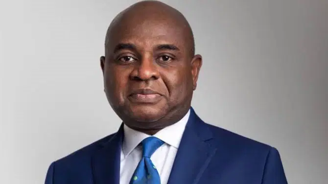

A former Deputy Governor of the Central Bank of Nigeria, Kingsley Moghalu, has thrown his weight behind a recent United Nations resolution that promotes the use of world maps depicting Africa’s true size, while insisting that the correction alone will not be enough to transform the continent’s economy.
Moghalu made this known in a post on his X account on Sunday, revealing that the UN General Assembly had voted 164-1 to adopt the “Correct the Map” resolution. The initiative was spearheaded by Togo on behalf of the African Group and received the backing of the African Union.
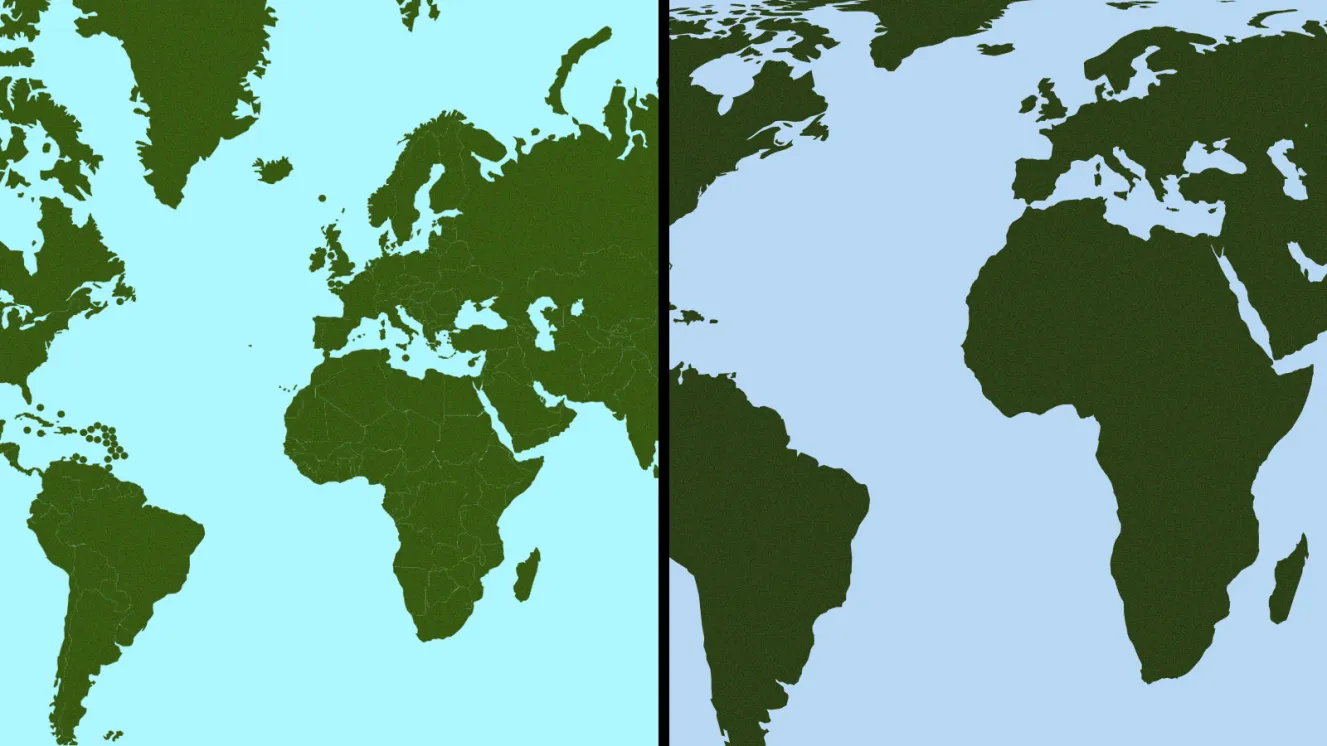
He explained that the resolution calls on schools, governments, international bodies and technology platforms to embrace equal-area map projections, such as the Equal Earth model, in place of the centuries-old Mercator projection.
According to him, the Mercator projection, which was created in the 16th century mainly to aid navigation, exaggerates the size of landmasses near the poles while shrinking those situated around the equator.
Moghalu pointed out that Africa is roughly 14 times the size of Greenland, even though the standard Mercator map makes both landmasses appear nearly equal in size.
He was quick to clarify that the UN resolution carries no legal weight, does not outlaw the continued use of the Mercator projection for navigational purposes, and will not affect existing national boundaries.
“The resolution is not binding. It does not ban Mercator for navigation. It does not redraw a border. It asks the world to stop teaching a distortion as geography,” he said.
He argued that the resolution’s importance extends far beyond the field of cartography, noting that maps shape how people around the world perceive the relevance and standing of different regions.
“Maps are never only maps. They are instruments of worldview. They tell children who is large and who is small, who is central and who is peripheral,” he said.
Moghalu maintained that fixing the skewed portrayal of Africa matters for the continent’s dignity and global image, but he cautioned that improved visual representation would not by itself translate into economic progress.
“A map can change how the world sees Africa. It cannot change how African states organise themselves,” Moghalu said.
Referencing his book, Emerging Africa, he described the continent as “emerging, not rising,” stressing that greater visibility and shifting narratives are not the same thing as real transformation.
He noted that lasting development depends on productivity, skills development, sound governance, strategic planning and a unified sense of national purpose.
“Development is first a state of the mind. Without that inner architecture — values, strategy, organisation — we keep mistaking symbols for substance,” he said.
He also cited the trajectories of Asian economies such as China, South Korea, Singapore, Taiwan and Vietnam, noting that their economic breakthroughs were the product of deliberate investment in education, industrial capacity, strong state institutions and long-term national strategies, rather than symbolic shifts in global perception.
“The map followed the factories, not the other way around,” he said.
He called on Africans to seize the corrected depiction of the continent as a chance to reconsider what could be accomplished with its expansive land mass and abundant resources.
“Teach the true size of Africa. Let children see that this continent can contain the United States, China, India, Japan, Mexico and much of Europe and still have land to spare,” he said.
Nonetheless, he challenged African leaders and citizens alike to move beyond mere pride in the continent’s size and instead concentrate on building productive economies.
“A fairer map is a beginning of perception. It is not the beginning of prosperity. The world does not owe Africa a projection. Africa owes itself a plan,” Moghalu said.